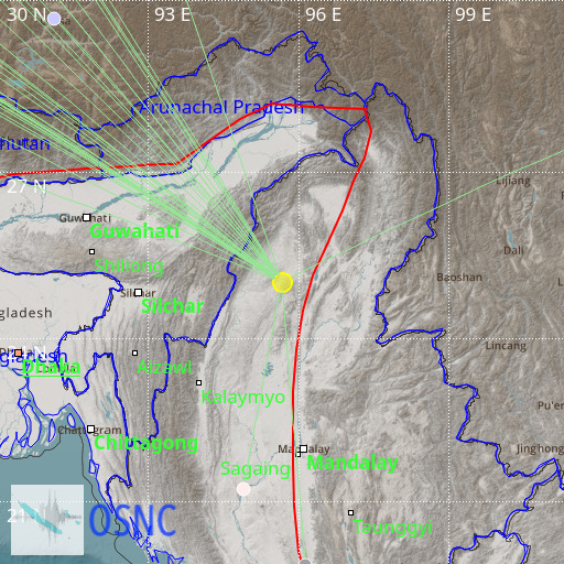
Myanmar-India Border Region
16/10/2025 06:57:51 (UTC) mB 5.8 159 Km

Localisation
- Myanmar-India Border Region
- Latitude : 25.02 °N
- Longitude : 95.66 °E
- Depth : 159 Km
Description
- Date : 16/10/2025 06:57:51 (UTC)
- Magnitude : 5.8 mB
- Phase count : 34
- RMS residual :1.51
Distance to nearest cities
- 77 kms of Homalin
- 117 kms of Kamjong
- 128 kms of Meluri
- 130 kms of Kiphire
- 131 kms of Jessami
- 131 kms of Ukhrul

