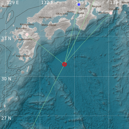
Southeast of Shikoku, Japan
28/10/2020 03:46:53 (UTC) MLv 4.6 5 Km

Localisation
- Southeast of Shikoku, Japan
- Latitude : 30.91 °N
- Longitude : 134.14 °E
- Depth : 5 Km
Description
- Date : 28/10/2020 03:46:53 (UTC)
- Magnitude : 4.6 MLv
- Phase count : 6
- RMS residual :2.34
Distance to nearest cities
- 236 kms of 土佐清水市(Tosa-Shimizu)
- 254 kms of 大月町(Ohtsuki)
- 256 kms of 四万十市(Shimanto)
- 257 kms of 黒潮町(Kuroshio)
- 262 kms of 宿毛市(Sukumo)
- 272 kms of 愛南町(Ainan)

